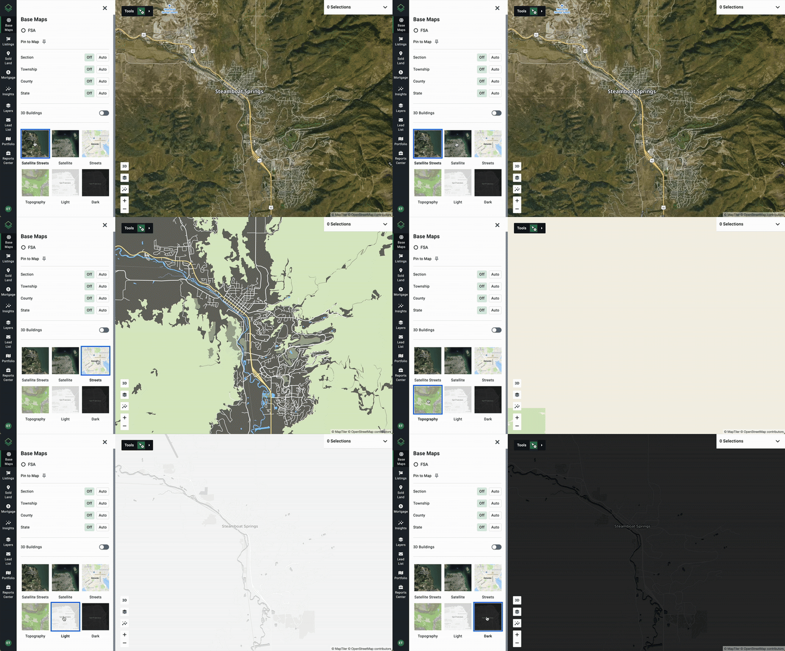
Most of your map customizations can be found under Base Maps. Find this by clicking on the top option on the main menu on the left hand side.
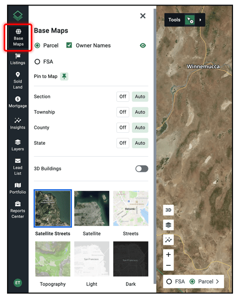
Here you can do the following…
- Change boundary lines from Parcel to FSA
- Hide or show all Parcel Lines
- Hide or show Owner Names
- + Pin this shortcut to the main map
- Hide or show lines and information for:
- Streets
- Section
- Township
- County
- State
- Toggle on or off 3D Buildings
- Change the base map view
- The Acres map has a number of distinct map views:
- Default Satellite
- Google Satellite (Enterprise Only)
- Classic
- Topography
- Light Mode
- Dark Mode