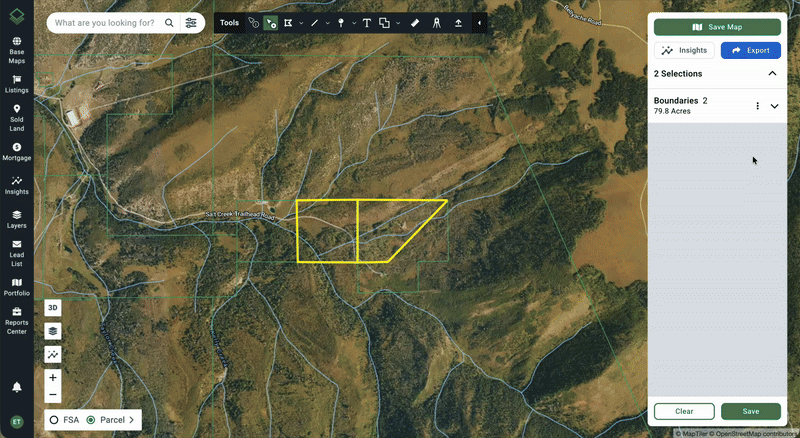
Steps
- Start by opening the map to the area that you want to capture.
- You do not have to have a parcel selected or a map saved to use this feature.
- You may consider adjusting certain viewpoint settings at this point. For instance, use a different base map or add a data layer.
- Click on Export on the top right of the map (at the top right of the right-hand selections panel).
- Click on Aerial Maps.
- A new screen overlay will appear. The map is still interactive on this screen. You can pan, zoom, and toggle on/off different features (3D mode, layers, insights, owner names, etc.) as desired by using the shortcuts on the bottom left.
- Select your orientation: Horizontal or Vertical.
- Click Take Screenshot.
- A preview of the screenshot will appear.
- Include a Report Name. (This will be auto populated if a saved map was opened.)
- You can choose to Include Logo and/or Add Contact.
- When the document is set up how you want, click Download in the top right.
- A PDF will automatically download to your computer. It will also be emailed to you and be saved to your Reports Center. Learn more: Access Your Reports
To get out of the preview screen, click ← Export or ← Back to Selections.
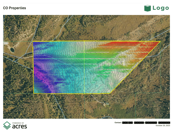
End Result Example